 |
| NPHS 1510: Federal and International |
| Geographic Information Systems (GIS) |
|
| |
| Geospatial Data Sources |
| |
| GIS data is one of the most widely published types of data. Data is created and shared by many organizations: |
- Government
- Academic
- Commercial
- Other
|
Federal GIS Data
Every federaal agency makes available some of it's maps, shapefiles and other spatial data. The listings below contain perhaps the most useful information for the emergency analyst. Two sites you should visit immediately are the FEMA site and the Census Site.
|
| |
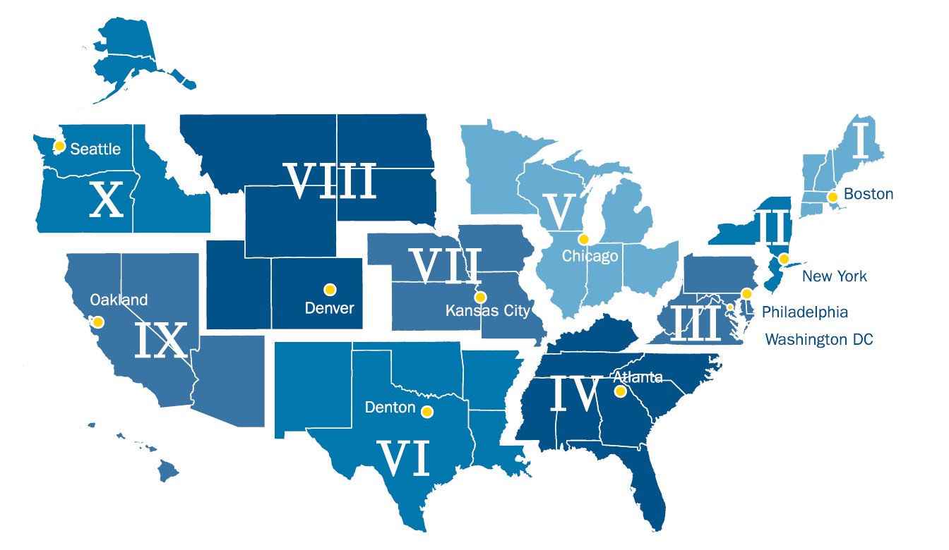
| Most agencies of the Department of Homeland Security www.dhs.gov Publish geographic information. Data can be found at TSA, ICE, Coast Guard and FEMA. The map below shows the FEMA regions and their regional headquarters. |
| |
 |
| |
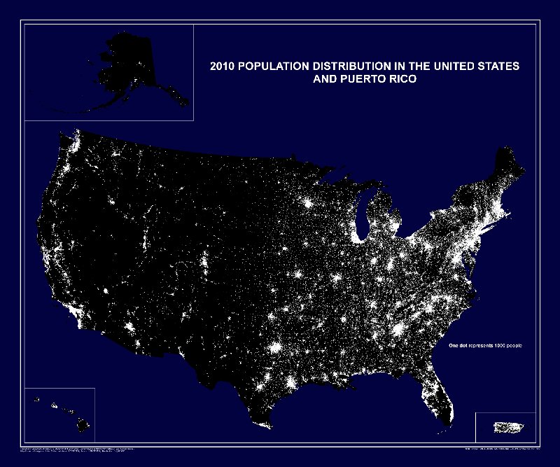
The U.S. Census Bureau www.census.gov produces spatial data on:
- People & Households
- Business & Industry
- Geography
|
| Perhaps the most popular map on the Census site, or any other site is the Night time Population Distribution Map. The 2010 map is shown below. |
 |
| |
| |
Major Federal Government GIS Web Sites
Department of Homeland Security (DHS) www.dhs.gov
Department of Defense (DOD)
Department of the Interior (DOI)
Department of Commerce (DOC)
U.S. Department of Transportation (US DOT)
Central Intelligence Agency (CIA) www.cia.gov
|
| |
| State and Local Sources |
| |
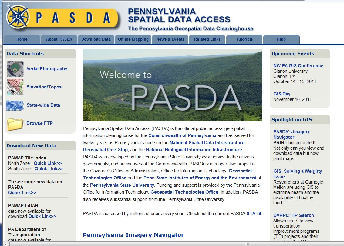
| As part of the National Spatial Data Infrastructure, each state has a geospatial data clearinghouse. Pennsylvania's is called PASDA the Pennsylvania Spatial Data Access Cleartinghouse. www.pasda.psu.edu. In addition to state data, many counties and municipalities have contributed content. |
| |
 |
| |
| Commercial Sources |
The DVD that you purchased accompanying ArcGIS has aa wealth of shapefiles and other data. The directory: "ArcGIS 10.0 Data, Maps, Streetmap USA"
has basemaps and thematic data for:
- Canada
- Europe
- Mexico
- World
- USA
- StreetMap USA
|
| |
| Exercise: |
Familiarize yourself with the vast amounts of data avaailable at all levels. Think about a map that would be useful for emergency planning in your area. Download the appropriate shapefiles and create the map. |
|
| |
|
|
|
|
| Copyright © 2011 Ken Sochats |


