 |
| Borders |
|
| |
| The table below provides links to materials which are relevant and applicable across all of the courseware in this program. For ease of access, this table is reproduced on every page of each lesson. |
| |
|
| |
|
| Ports |
The table to the right provides access to the maps used in this module.
By clicking on one of the links you can get a large version of each of the maps.
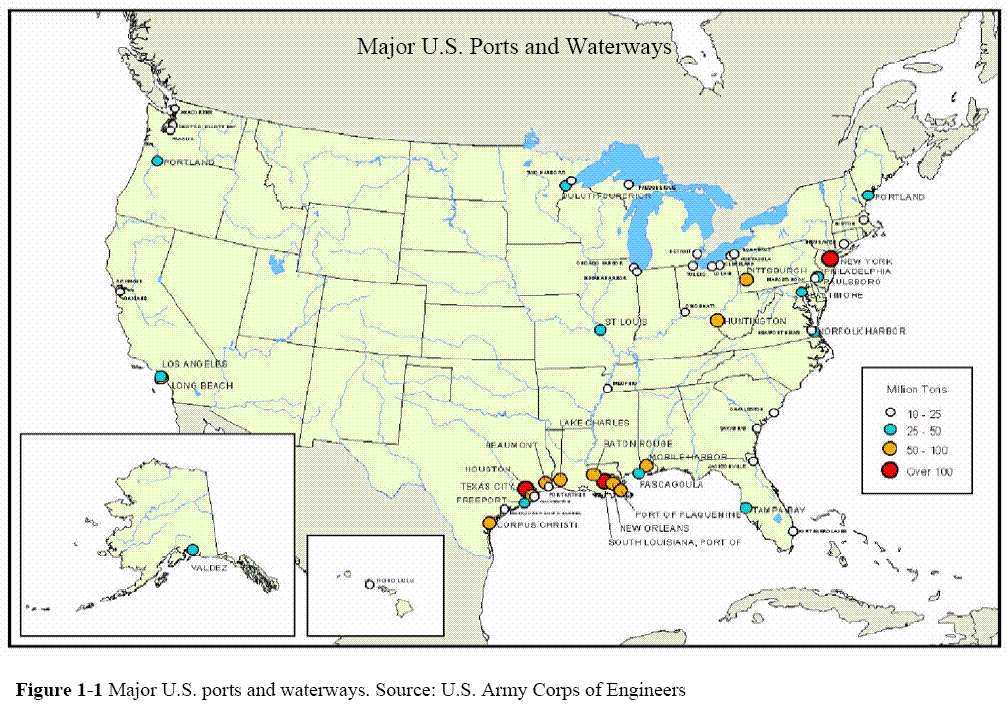
There are 361 ports in the United states. This module focuses on coastal ports. |
Ports
US Port Traffic
Baltimore, MD
Boston, MA
Charleston, SC
Fort Lauderdale, FL
Honolulu, HI
Houston, TX
Jacksonville, FL
Los Angeles, CA
Miami, FL
Mobile, Al
New York City, NY |
Norfolk, VA
Panama City, FL
Philadelphia, PA
Port Canaveral, FL
Portland, ME
Portsmouth, NH
Providence, RI
San Diego, CA
San Francisco, CA
Savannah, GA
Seattle, WA
Tampa, FL
Washington, DC |
|
|
|
US Port Traffic
 |
| Definition: |
Megaports Initiative: “NNSA's [National Nuclear Security Administration, DOE] Megaports Initiative, which began in 2003, teams up with other countries to enhance their ability to screen cargo at major international seaports. The Initiative provides radiation detection equipment and trains their personnel to specifically check for nuclear or other radioactive materials. In return, NNSA requires that data be shared on detections and seizures of nuclear or radiological material that resulted from the use of the equipment provided. The Megaports Initiative has three main objectives:
- Deterring terrorists from using the world's seaports to ship illicit materials;
- Detecting nuclear or radioactive materials if it shipped via sea cargo; and
- Interdicting harmful material before it is used against the U.S. or one of our allies.
In cooperation with foreign governments, Megaports representatives determine the most effective placement of radiation equipment for each seaport. Installed sensors then screen cargo containers for special nuclear or other radioactive materials. If anything is detected, the sensors alert foreign port officials of the need to further examine the cargo so they can take appropriate action.”
Source: NNSA/DOE, Megaports Initiative, 2008.
|
|
| |
| Definition: |
Port Security Assessment (PSA) Program. “The mission of the Coast Guard Port Security Assessment (PSA) Program is to improve port security. We will do this by making federal, state, and local governmental agencies and other appropriate port stakeholders aware of the susceptibility of maritime critical infrastructure and key assets to negative consequences from subversive acts of terrorism, and to recommend mitigation strategies to protect our national port system and the United States public.”
Source: USCG, Port Security Assessment Program.
|
|
| |
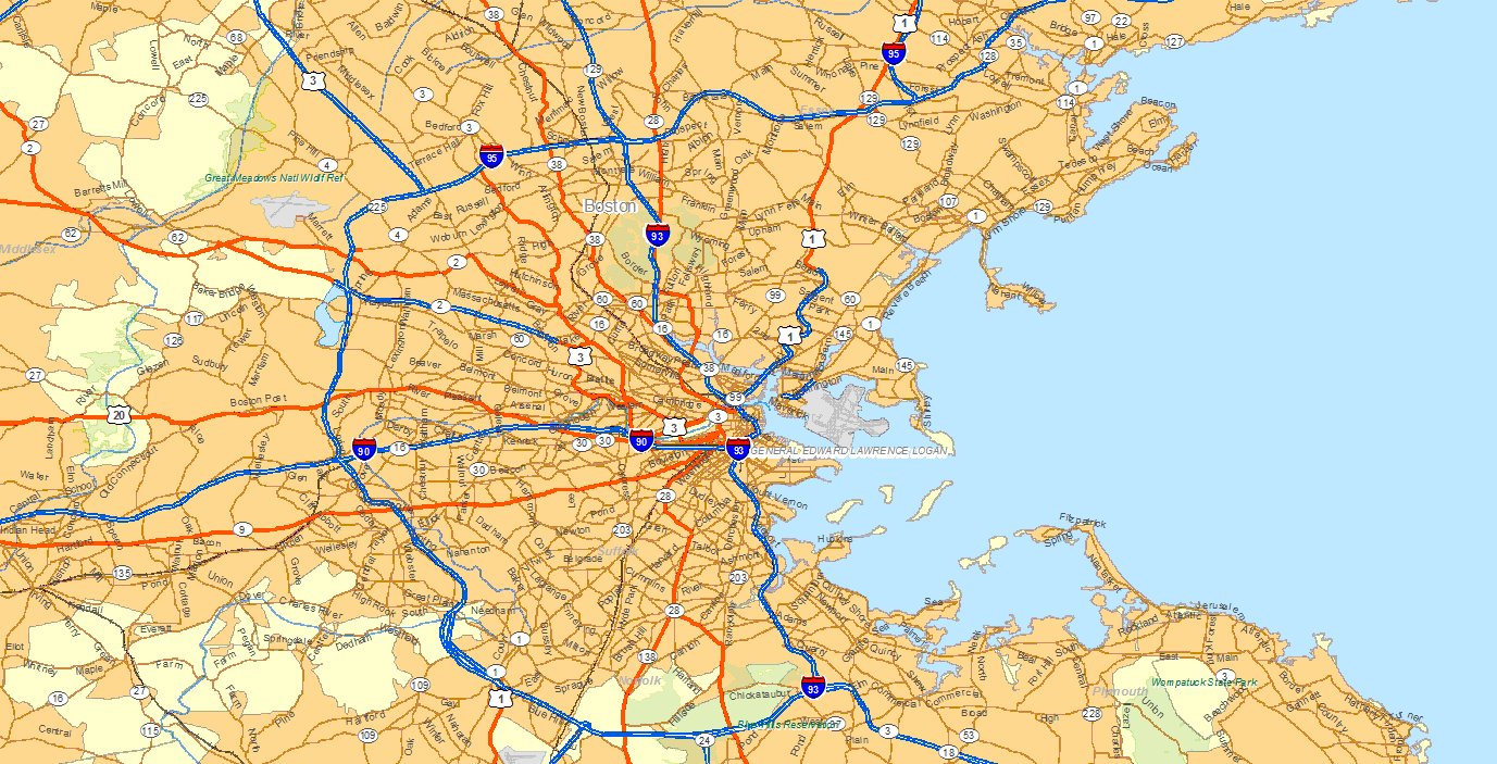
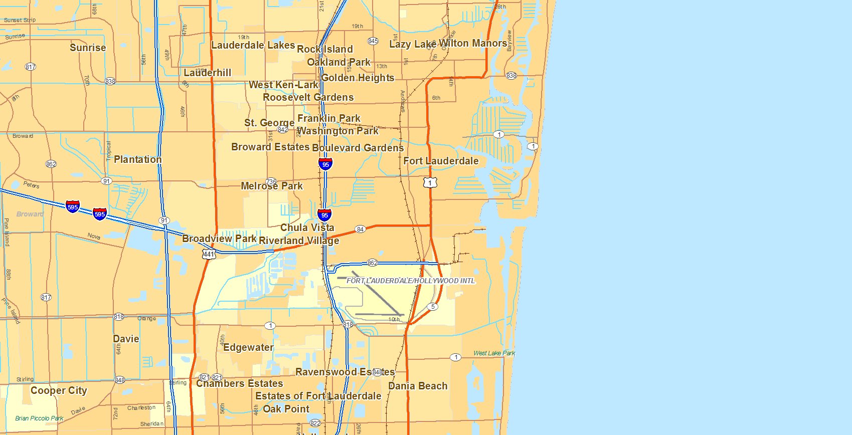
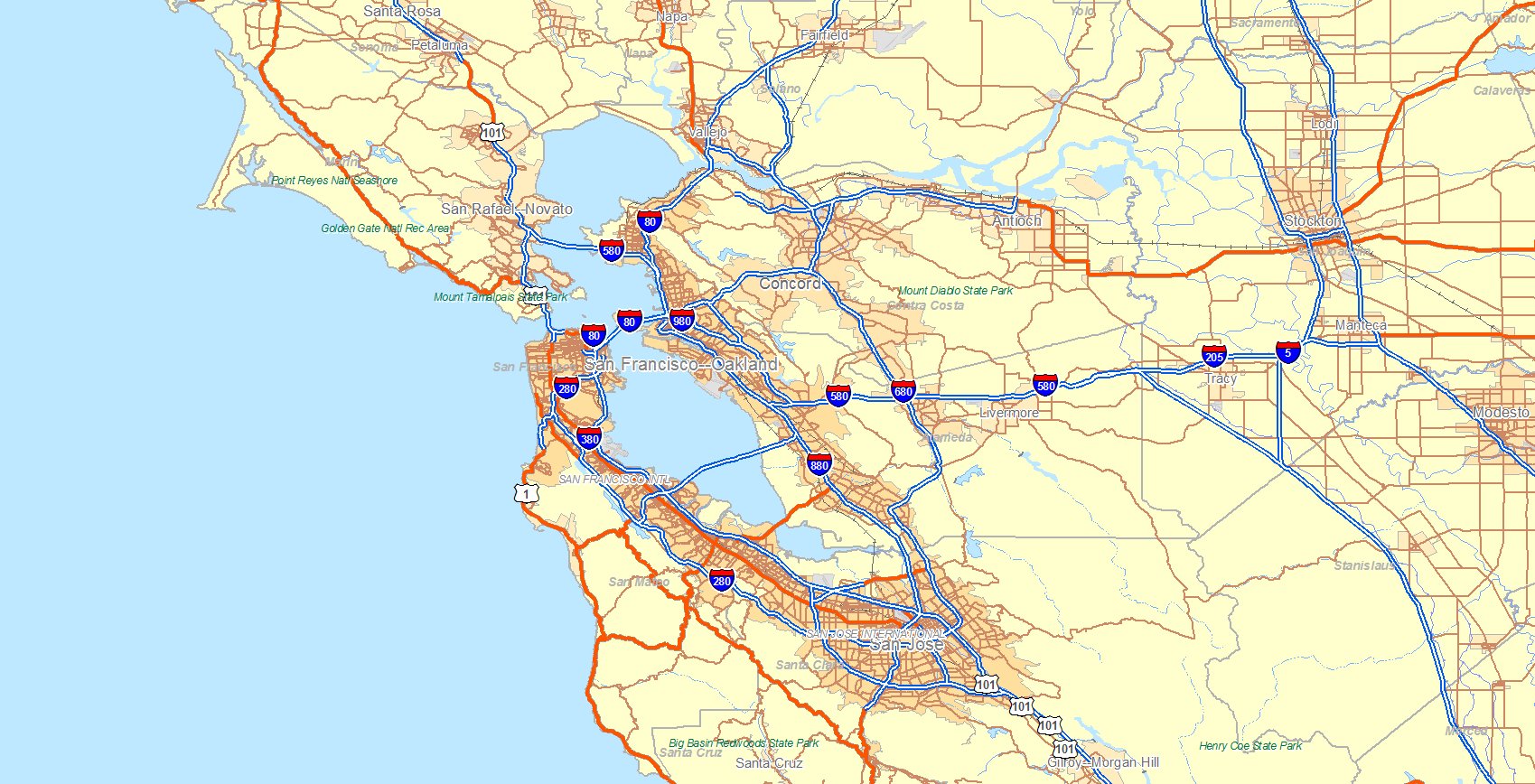
The three maps that follow show typical US ports. Below each map is a link to the Google Map for the port.
Notice that for each port, the very irregular shape of the port makes security problematic. Also note that the road, rail and air systems tend to converge at the port. This is important for two reasons:
- events that occur at the port will tend to disrupt the road and rail systems
- contraband and illegal persons can be rapidly transported toward the interior
|
| |
Boston, MA
 |
| Google map of Boston |
| |
Fort Lauderdale, FL
 |
| Google map of Fort Lauderdale |
| |
San Francisco, CA
 |
| Google map of San Francisco |
| |
|
| Port Architecture |
| |
Ports all over the world, particularly older ones, share a common structure or architecture. In particular, they must:
- Be deep enough to service ships.
- Provide docking facilities.
- Be defensible.
- Have facilities for human traffic (quarantine).
The following ports are examples we will use to illustrate this architecture.
|
| |
>New York City, NY. |
| |
| Charleston, SC. |
| |
| San Francisco, CA. |
| |
| San Juan, PR. |
| |
| Havana, Cuba |
| |
| Lisbon, Portugal |
| |
|
| |
| Definition: |
Port Security Grant Program (PSG): “PSG funds owners and operators of ports, terminals, as well as port authorities and state and local agencies that provide a layered approach, U.S. inspected passenger vessels and ferries, as well as port authorities and State and local agencies to improve security for operators and passengers through physical security enhancements. The Program strives to create a sustainable, risk-based effort for the protection of critical infrastructure from any incident that would cause major disruption to commerce and significant loss of life.”
Source: DHS/ODP, FY 2006 EMPG Program Guidance, November 2005, p. 10.
|
|
| |
| Definition: |
U.S. Customs and Border Protection: the unit of the U.S. Department of Homeland Security that secures the homeland by preventing the illegal entry of people and goods while facilitating legitimate travel and trade.
Source: www.cbp.gov
|
|
| |
| Exercise: |
Examine the maps of the ports listed. Identify the commonalities and differences between the ports.
|
|
| |
|
|
|
|
|
| Copyright © 2011, 2024 Ken Sochats |


